")

(DDM) – The July 4th flash flood that devastated communities along the Guadalupe River in Texas Hill Country has exposed a harsh reality: the threat of deadly flood waves is growing and not confined to one state.
Diaspora Digital Media (DDM) gathered that in a matter of hours, a surge of water surged through campsites and neighborhoods, killing over 130 people and displacing hundreds of families.
The destruction left in its wake was sudden and immense, a grim reminder that flash flooding remains one of the most lethal weather phenomena in the United States.
According to emergency officials, the catastrophe unfolded with terrifying speed. Within just two hours, riverbanks were breached, vehicles were swept away, and tents were flattened.

The forces behind the flood were a combination of swollen rivers, steep terrain, and unsuspecting people relaxing in recreational areas that became death traps once water levels rose.
Experts warn that these dangerous conditions are not unique to Texas.
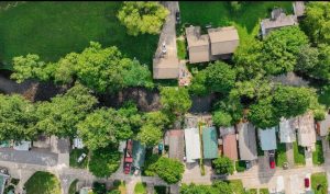
Many locations across the U.S. share similar vulnerabilities, especially in scenic areas that attract tourists seeking to escape city life.
Environmental scientists explain that canyons, valleys, and narrow riverbeds act like funnels, amplifying water flow when heavy rains fall upstream.
The very geography that makes these regions attractive for hiking, camping, and water recreation also makes them deadly under the right storm conditions.
Climate risk researchers note that flash floods are unpredictable because of how rapidly they form.
Often, there is little warning before a wall of water crashes into populated areas.
First Street, a leading climate research group, partnered with CNN to identify regions across the U.S. where rivers and streams remain especially susceptible to fast-forming flood waves.
Their findings point to a growing pattern of overlooked flood zones, not just in traditional floodplains, but in places where people least expect them.
The study analyzed how quickly water levels can rise, how frequently flash floods occur, and how long they last.
A major concern is that many Americans who visit flood-prone recreation areas remain unaware of the danger, especially when weather conditions change abruptly.
The warning signs are not always visible.
Local authorities in flood-prone counties report that many casualties happen when visitors camp too close to riverbanks or attempt to cross roads covered in flowing water.
A map created by First Street and hydrology researchers shows blue dots across the U.S., each representing a water-level gauge prone to flash flooding.
These gauges are monitored by the U.S. Geological Survey and track how fast rivers swell during rain events.
The concentration of dots across the Midwest, Appalachia, and parts of the Southeast indicates that flash flood risk is widespread and not limited to the Southwest.
Data from the study by Li et al. (2023), published in Geophysical Research Letters, outlines the systemic risks facing rural and suburban communities.
Their research confirms that many small towns and natural parks are among the most vulnerable zones, especially those located near fast-moving rivers or streams fed by nearby mountains.
With climate change contributing to heavier rainfall events and more extreme weather patterns, flash floods are expected to become more frequent and more severe.
Scientists now emphasize the need for updated flood warning systems, better signage in recreation zones, and more public education about the speed and danger of these floods.
“These are not slow-moving disasters,” one hydrologist involved in the research warned.
“A two-hour storm can change the landscape entirely, turning a peaceful stream into a deadly torrent.”
Survivors from the Hill Country flood described a terrifying scene of panic and confusion, with families fleeing rising waters in the dark.
Rescue teams scrambled to locate people trapped in trees, submerged vehicles, and washed-out roads.
Emergency responders say that some of the victims never stood a chance because the water moved faster than any forecast had predicted.
Policy advocates are now calling for stricter zoning laws in areas near vulnerable rivers, and a national campaign to inform outdoor enthusiasts about the hidden flood risks in popular destinations.
They argue that local governments must reassess where people are allowed to camp or build, especially as storms intensify and historic flood patterns are reshaped by climate change.
Environmental groups have also urged Congress to fund the expansion of river monitoring infrastructure and early warning systems nationwide.
They believe that enhanced data collection, combined with public outreach, can help prevent future tragedies.
As communities across America remember those lost in the Guadalupe River flood, experts warn that similar disasters could strike anywhere.
The next deadly wave, they say, is only a storm away.
For readers who wish to assess flood risks in their own communities, an interactive map is available online, pinpointing flood-prone river locations based on U.S. Geological Survey data.
The map allows individuals to search by ZIP code or city, offering a visual guide to where water-level gauges are detecting high flash flood risk.
As the summer season continues and more Americans travel to rivers, lakes, and forests, the message from scientists, emergency planners, and survivors is clear:
Stay informed, stay alert, and never underestimate the power of rising water.
👇👇👇
Follow DDM’s official WhatsApp Channel for real-time updates.
https://whatsapp.com/channel/0029Vajkwdc4dTnFHl19vW3g